Hawk Eye Aerial Imaging and Mapping Solutions

Hawk Eye Aerial Imaging and Mapping Solutions offers a wide range of services using enterprise as well as consumer grade drones for photogrammetry.

Our solutions include planning the mission, ground survey for control points, image acquisition, processing point cloud, elevation data and Ortho as well as 3D models for high precision mapping, using Survey of India CORS services and survey grade GNSS receivers, achieving sub centimetre accuracy. 

Specializing in Drone Services and Aerial Photography

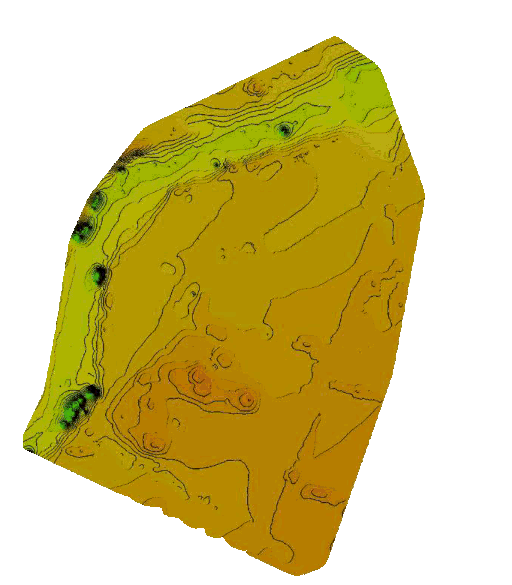
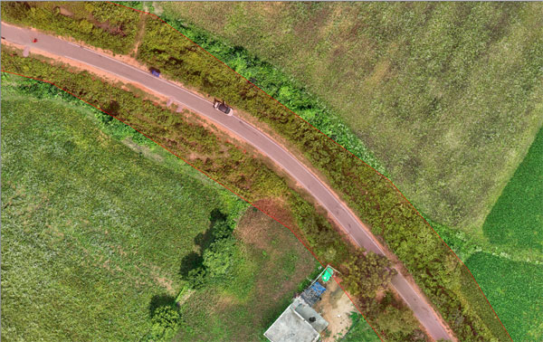
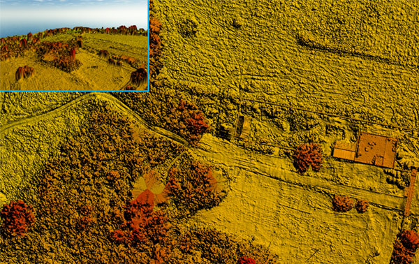
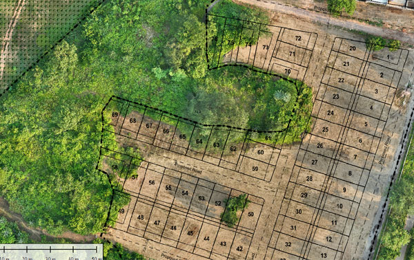
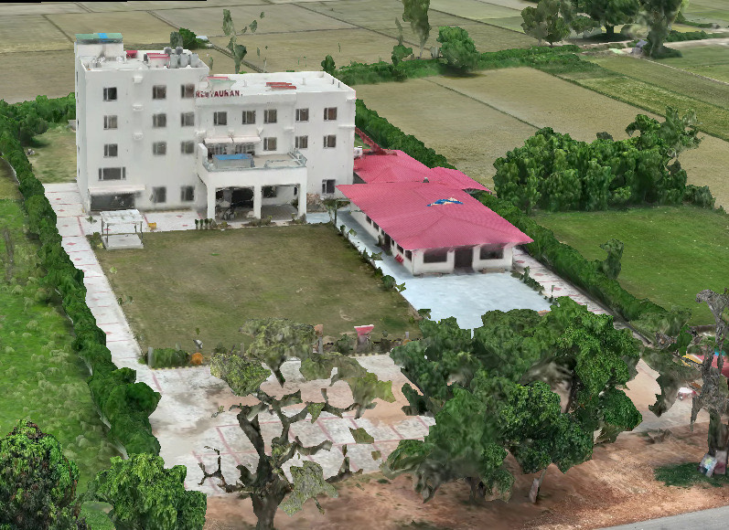
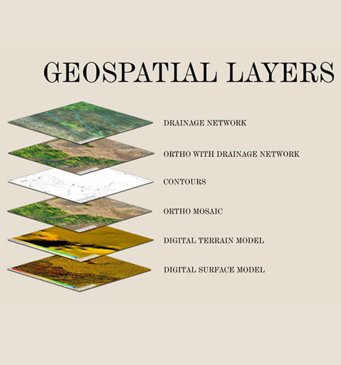
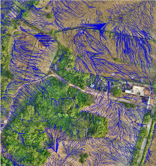
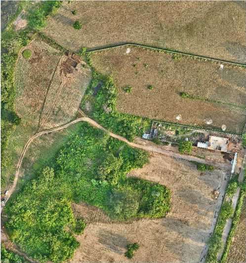
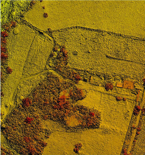
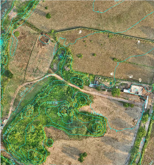
Hawk Eye Aerial Imaging and Mapping Solutions offers a wide range of Aerial Imaging and Processing solutions using enterprise as well as consumer grade drones for photogrammetry. Our solutions include planning the mission, ground survey for control points, image acquisition, processing point cloud, elevation data and Ortho as well as 3D models for high precision mapping, using Survey of India CORS services and survey grade GNSS receivers, achieving sub centimetre accuracy. The company also provides customers high resolution videos and images of their sites and events.

Our Offerings Include

Large Scale Mapping Solutions

Corridor Mapping

Digital Surface Model & Digital Elevation Model

Orthophoto

Survey & Inspection

Geospatial Layers

Hawk Eye Imaging & Mapping Services Pvt Ltd

A new entrant in the field of imaging and mapping services is Gurugram based Hawk Eye Imaging & Mapping Services Pvt Ltd. The company has been established by an Indian Army veteran , who during his career spanning 35 years involving service in operationally challenging environment developed an active interest and expertise in the use of drones for imaging and mapping. Brig Mishra believes that drones have not adequately been explored and exploited for civilian use, and hence the venture set up by him seeks to make available a range of drone based imaging and mapping services to private and public entities. A DGCA certified Drone Pilot, he has carried out large scale mapping as well as long range surveillance while in the Army. The company uses state of the art Enterprize Drones with RTK module, high precision GNSS Receivers, and Survey of India Continuously Operating Reference Station (CORS) Network for centimeter level accuracy.

Drone Flights Completed
0 +
Projects across Country
0 +
Trusted Industrial Clients
0 +
Surveys Processed
0 +

Data Collection

The drones used by us offer a very detailed imagery with large sensor and mechanical shutter that eliminates motion blur. For the Ground Control Points, we use high precision GNSS base stations and rovers connected to Survey of India CORS network for real time correction and the same data is also used by the RTK module on the drone, ensuring high precision and accuracy.

3D Models

We provide 3D Models of sites, buildings and monuments with high precision and accuracy that can be used for walk through, visualization, planning and monitoring progress of construction

We provide highly accurate mapping of buildings delivered in formats that allows our clients to carry out accurate measurements without investing in any expensive software.  This data can also be used for cadastral survey, revenue records and for planning utilities.